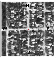
 Here is the satellite photograph from Aril 12, 1998. The coordinates are about 89W 00' 3.5" x 40N 27' 4.0". North is at the top and west is to the left. The Big "Japanese" Bridge is just about in the center of the picture. Park Hill Cemetery is across Morris Avenue to the west. The tennis courts are visible on Summit Street near the upper right corner.
Thanks to Terraserverdotcom.


No comments:
Post a Comment